
Research question
How did the M’Clintock Channel Ice Stream and its associated ice shelf in the Canadian Arctic Archipelago evolve and collapse at the end of the Last Glaciation?
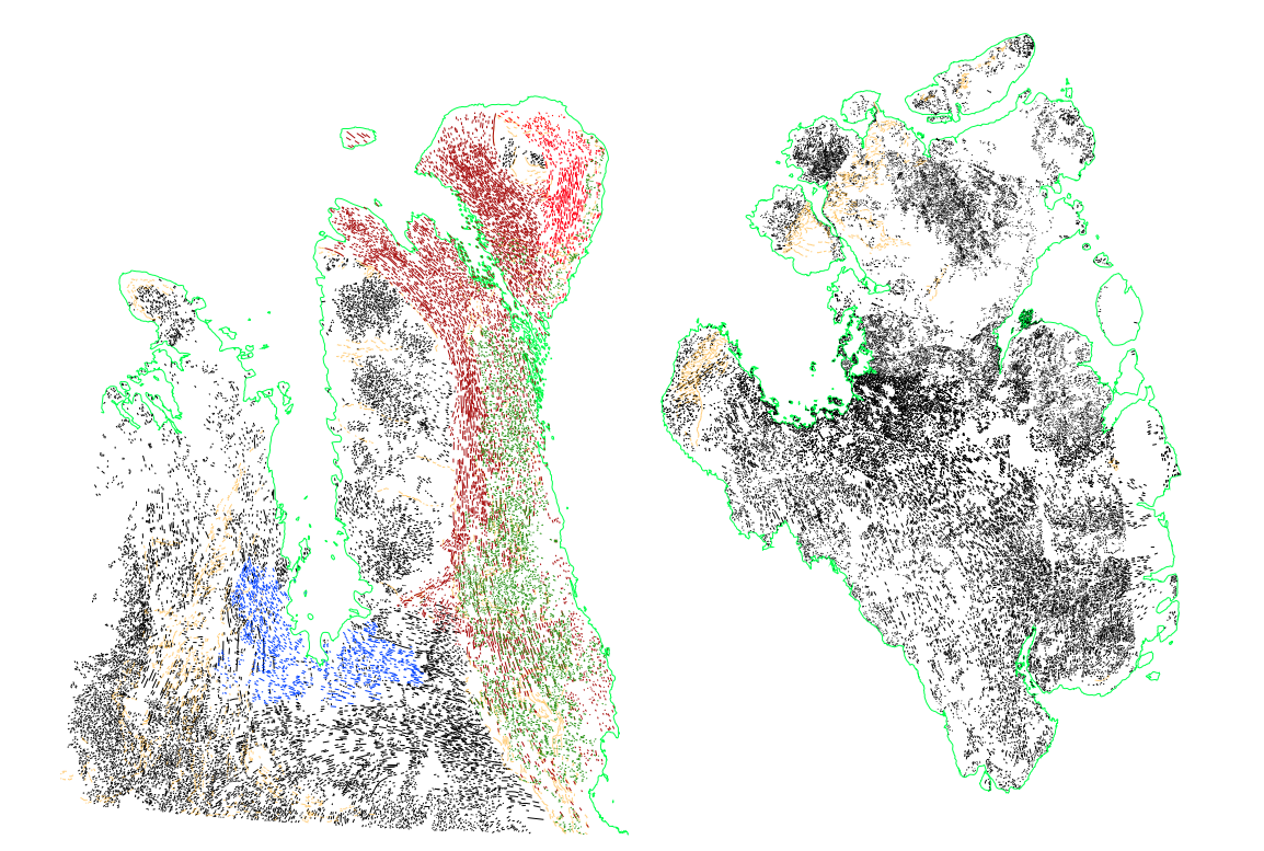
Can GIS mapping the flowsets indicated by elongate glacial bedforms in satellite imagery on adjacent Victoria and Prince of Wales islands elucidate ice flow patterns and help determine when this sector of the Northwest Passage first opened?
Project description:
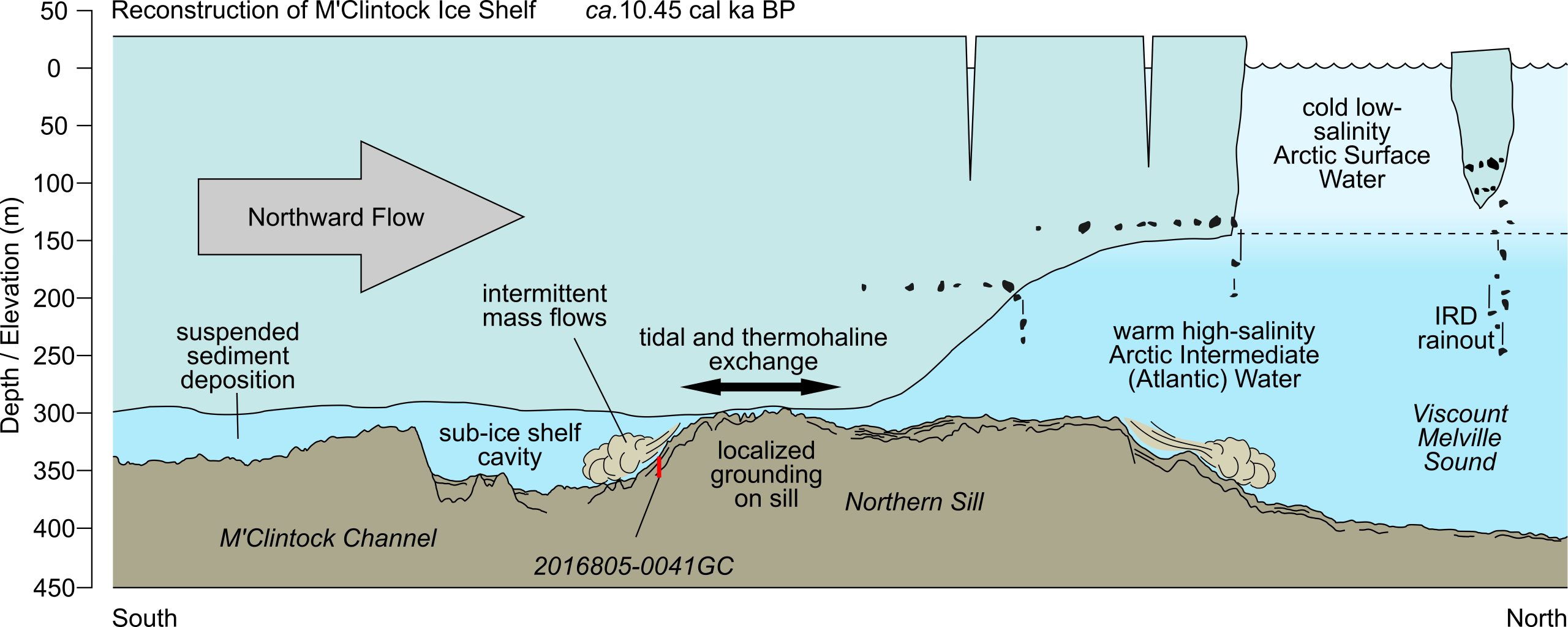 Characterising the style of timing of deglaciation across complex archipelago settings is vital if we are to understand how ice sheets collapse under warming climates and make solid forecasts for the future. This work seeks to complete the ongoing mapping efforts of the palaeo M’Clintock Ice Stream and M’Clintock Ice Shelf in the Canadian Arctic – a vital outlet for the collapsing Laurentide Ice Sheet at the end of the Last Glaciation.
Much work has already been done characterising sediment core records and correlating radiocarbon ages from the region to determine how extensive the M’Clintock Ice Shelf was and how rapidly it collapsed. However, the mapping of former ice stream pathways across the adjacent islands of Victoria and Prince of Wales is only at an early stage. Much has been mapped graphically but has not been completed in a useful shareable GIS format.
This project seeks to complete the GIS mapping of the area and to convert previously mapped vector data in .cdr format to .dxf and thus into ArcGIS. The tricky part will be to interpret the relative chronology and cross-cutting relationships of the flowsets.
The project involves:
 The project is a desktop-based study working with ArcGIS to import and map date from a range of existing images and previously mapped sources.
The project will also require the interpretation of the mapped ice stream flow sets to determine the sequence in which the ice streams switched on and off during deglaciation.
Starting date/period: April 1., 2025
Involvement
This is a paid opportunity at the rate of NOK 207.38 per hour.
The number of work hours is open to negotiation, depending on the level of commitment required, but would be in the order of 20 to 30 hours.
The result of this work will contribute to a published peer-reviewed scientific paper in a leading research journal. As a student assistant, you can expect to be a co-author on this paper and to play a role during the completion of the writing and review stages.
Experience/skills to be acquired
You will gain direct experience of the research and publication-writing process, coupled with expanding your GIS skills. You will further develop your understanding of deglacial processes and ice stream and ice shelf dynamics in a broad arctic region beyond Svalbard adding an important international level to your polar understanding.
Prerequisites
A well-developed and detailed practical knowledge of GIS mapping programs such as ArcGIS and/or QGIS is required.
Previous experience in mapping geological or geomorphic landforms is considered necessary.
A knowledge of glacial geomorphology, megascale glacial bedforms, and ice stream behaviour (either terrestrial or marine) is considered advantageous.
Interested in this project or need more info? Contact: Mark Furze (markf@unis.no)
Project number: 34